1C.2: Use and interpret maps.
CONCEPT #1: Maps are used to represent and identify spatial patterns and processes at different scales.
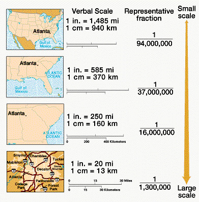
What is cartographic or map scale?
|
ADD INFORMATION ABOUT SCALE OF ANALYSIS ...GEOGRAPHIC SCALE
|
|
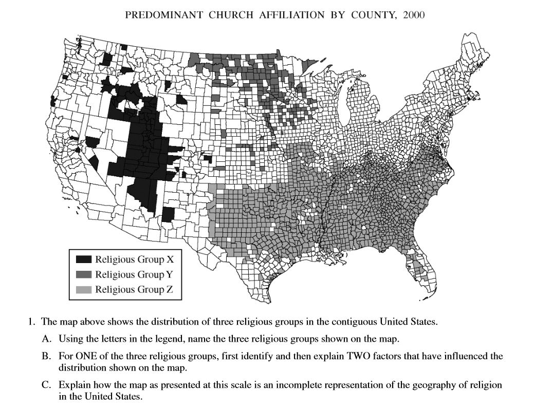
Example from the AP Exam - 2009, Question #1 |
|
CONCEPT #2: Types of maps include reference maps (e.g., physical and political maps), and thematic maps (e.g., choropleth, dot, graduated symbol, isoline, cartogram)
ADD PICTURES OF EACH TYPE OF MAP
CONCEPT #3: All MAP PROJECTIONS (e.g., Mercator, polar) inevitably distort spatial relationships (e.g., shape, area, distance, direction)
ADD INFORMATION ABOUT MAP PROJECTIONS AND DISTORTION